Mark Yong is CEO and cofounder at Garuda Robotics, a developer of enterprise robotics and analytics solutions. Yong was previously a lecturer in the School of Computer Engineering at Nanyang Technological University in Singapore. He was trained at Carnegie Mellon University and the University of Michigan.�
Emily Reigart:Your company, Garuda Robotics, was founded in 2013 and provides solutions for agriculture, infrastructure and security, all using drones in various ways. What is your background and how did you get involved with the company?
Mark Yong:Prior to founding the company, I was a lecturer in the School of Computer Engineering at Nanyang Technological University in Singapore. I�ve worked on various robotics systems � for urban search and rescue, autonomous field operations and STEM education. I left academia to start a company that would develop technology products to address tangible real-world problems.
Reigart:Typically, when a tower site is studied, engineers use computer modeling and terrain data. What does a tower site survey entail and what parts of that cannot be done with a drone? E.g., is there some sort of structural analysis that has to be done hands-on versus visually?
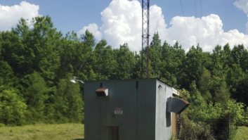
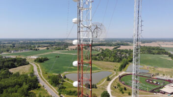
Yong: Garuda TowerSight�s primary use case is a set of tasks known as line-of-sight verification: When selecting a new tower site, LOS to existing towers must be confirmed because connectivity between towers relies on point-to-point microwave links.
LOS verification requires the surveyor to be positioned about 30 m in the air (where the antenna would be) via a scissor lift. Each candidate new site is associated with three or four possible existing towers as relay targets; the surveyor uses a zoomable camera to capture images of each distant tower as proof of LOS. This is obviously a slow process with the surveyor having to work at heights; images captured by the camera tend to be of low quality as well due to the lack of stabilisation on the camera.
Reigart:What is a communications infrastructure maintenance survey, and how does use of a UAV provide a benefit versus traditional methods? How is the use of a UAV faster and/or more effective?
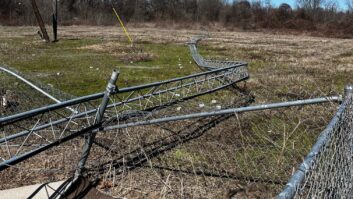
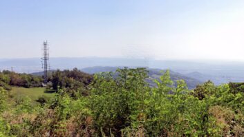
Yong:Towers need to be periodically inspected to ensure that cables remain connected, structural members are free of corrosion, and antennas continue to be pointed in the correct direction.
The traditional method of carrying out these inspections relies on trained workers to climb up towers for manual visual inspections. The TowerSight system reduces the need for risky work-at-height deployments. Instead, inspections may be carried out using the onboard zoom camera to obtain close-up images of various mounted structures while keeping a safe distance from the tower itself.
Reigart:Your website says that Garuda TowerSight system can improve users� productivity because they can �complete tower surveys three times faster than using traditional methods.� How was that figure calculated?
Yong: At a candidate new tower site, the LOS survey for four remote towers as described above takes 30-60 minutes, assuming the (rented) scissor lift vehicle arrives on time. Using TowerSight, this can be completed in less than 9 minutes.
That said, it is very common for scissor lift operators to arrive late (up to six hours, based on our field studies), which further increases the relative efficiency of the TowerSight system.
Reigart:Explain the TowerSight app and how it works with TowerSight UAV and overall system. Is the video transmitted via the device�s cellular network?
Yong: TowerSight integrates with enterprise IT backend systems to ensure seamless information flow from planning to execution to data analysis and presentation. The key to a successful survey is in the pre-planning process.�
- Tower locations are pulled from the client�s databases and used to plan an automated survey flight path. This is pushed to the TowerSight App in preparation for field deployment.
- On the ground, operations staff only need to launch the TowerSight App, retrieve the appropriate mission plan and launch the automated survey. The TowerSight UAV will rotate to face each remote tower in turn; for each tower, the operator uses the App controls to zoom in on the remote structure and trigger the capture of the on-screen image.
- Once the survey flight is complete, the results of the LOS survey (images captured plus relevant metadata) are automatically transmitted to the client�s databases.
Video is transmitted to the TowerSight App via a local link to the UAV. Results of the LOS survey can be transmitted over the cellular network to the client�s IT backend systems.
Reigart:What is the make and model of camera used? What is the resolution?
Yong: The current version of the camera supports the requirements of tower LOS and inspection operations; it provides a Full HD 1080p video feed and can capture up to 3 MP images.
Reigart:Your company is based in Singapore. Are your products available in the U.S.? Europe? Have you obtained or applied for any FAA waivers, and if so, for what?
Yong: We have been operating in Asia and our initial product launch is in the Southeast Asian region where tower building activity has been the greatest in recent years. We also provide managed drone services in the SEA region.
We are exploring a global rollout for TowerSight in the coming months and are speaking to potential partners. We will comply with civil aviation regulations in any regions we operate in. We were one of the first commercial UAV operators in Singapore to be awarded the Unmanned Operator Permit by the Civil Aviation Authority of Singapore.
�