A Saturday session of the Broadcast Engineering & IT Conference will explore “Using Drones to Verify FM Antenna Performance.”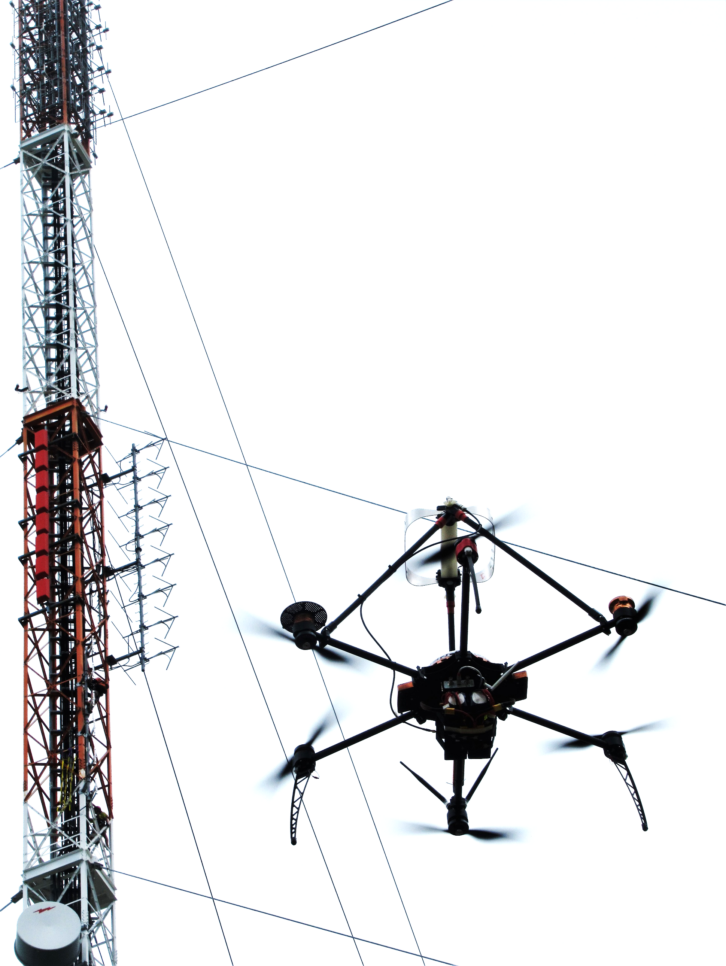
John Schadler is vice president of engineering for Dielectric LLC, which makes antennas, RF systems components and transmission line. Jason Schreiber is managing director of Sixarms, which uses drones to provide measurement solutions for broadcasters and other industries.
Radio World: What is your session about?
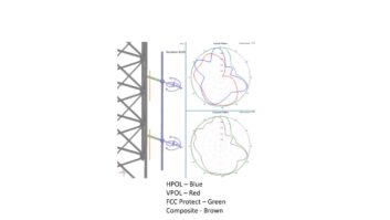
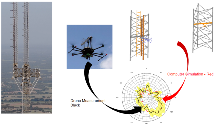
John Schadler: The paper will discuss the power of computer simulation and validate the predictions through comparisons to drone measurements. This in turn also shows the ability drone measurements have to verify antenna system performance.
It will include case studies, one of which would be impractical for any far-field range and can only be realized using simulation and validation using drone-based measurements.
RW: Can you remind us about the FCC rule change that is the context for this?
Schadler: In June of 2021, Dielectric filed a proposed rulemaking with the FCC to allow the use of computer simulation to verify the performance of directional FM antennas. In November of 2021, the FCC showed very strong support of the proposal by unanimously deciding to move forward with the notice of proposed rulemaking and reduce the public comment period down to 30 days.
In May of 2022, new rules were adopted that give FM license applications the option of submitting computer-generated proofs of FM directional antenna patterns from the antenna’s manufacturer in lieu of measured pattern plots and tabulations. That strong support and quick adoption stem from the benefits and evident accuracy that simulation offers over traditional range measurements.
RW: How does the rule change bring drones into the discussion?
Jason Schreiber: The drone pattern measurement solution is used to validate and compare to the computer simulations.
Schadler: It supports simulation as an extremely powerful and accurate tool. It replaces physical modeling, prototyping and pattern test ranges.

RW: Tell us about the technology and the process involved.
Schreiber: Drone-based antenna pattern measurements are a relatively new technique, approximately 10 years, used to replace traditional helicopter and land-based field strength measurement practices. What was typically a very manual and time-consuming process is now fully automated, from the data collection to the drone flight path.

Schadler: The computer simulation process imports detailed Solid Edge CAD drawings of the antenna and tower into ANSYS HFSS software, where the model is broken down into a tetrahedral mesh, and Maxwell’s equations are solved at each node to produce radiation characteristics of the entire structure. Since the calculations are exact at each node, a detailed model with a tight mesh leads to an exact solution for all practical purposes.
RW: I understand that Sixarms will introduce the use of tower imaging to obtain more accurate tower information.
Schreiber: Drones are currently playing a major role in creating “digital twins” of critical infrastructure. That is, a complete tower full of antennas and cables can now be mapped in three dimensions using a drone. Two major techniques are photo-based, or “photogrammetry,” and laser-based “lidar.” Both solutions now allow us to create full digital twins of our infrastructure to allow for planning, maintenance and auditing.
RW: How many broadcasters have used these technologies as you’ll describe?
Schadler: Since the start of the repack, Dielectric has designed more than 1,500 high-power antennas in a completely virtual environment as well as performed more than 100 UHF and VHF nearfield drone comparison studies.
Schreiber: Since 2014, Sixarms and our partners have measured more than 800 antenna patterns by drone. These include AM and FM radio, HD Radio and VHF and UHF digital TV. This drone-based technique is being used by major U.S. and international broadcasters as well as broadcast infrastructure companies to validate that the antennas they have implemented have been manufactured and installed successfully.
RW: What else should an engineering reader know?
Schadler: During the repack, extensive experience has been gained in drone measurement techniques as well as computer simulation of radiating structures. It has been shown that computer simulation and drone measurements are an accurate and cost-effective alternative to traditional FM range measurements and can predict and measure the performance of structures, which today would be impractical to perform any other way.
In the future, tower mapping can provide the means for more accurate simulation models, leading to even more exact results. For the present, though, a drone pattern measurement solution can be used to understand the impacts of the supporting structure and other structures in the FM radiating pattern.


