When it comes to radio engineering and propagation, everyone has questions. Station owners wonder whether simple improvements can be made to reach that critical audience to drive sales. Prospective owners want to know if their business plan to serve a particular audience has a chance of success. Even experienced radio engineers know that radio wave propagation and the art of successful broadcast engineering involve a complex mix of science, experience and sometimes even intuition.

Clarence Beverage
Clarence Beverage of Communications Technologies Inc. of Marlton, N.J., talked with us about a range of relevant issues, from how one can evaluate a possible station acquisition properly to an explanation of how FM broadcast signals are characterized statistically.
Radio World:For years we have seen radio station brokers include coverage maps with descriptions of available properties, often using the FCC licensed 60 dBu or 40 dBu contour. Is this a good way to estimate the actual coverage of an FM radio station? How about the 2 mV contour for AM stations?
Beverage: This is an excellent question and opens the door to discuss some very important reasons why brokers, owners, managers and anyone else in the industry who need to understand a station’s coverage area should not rely on contour maps alone.
First FM contour maps. The first reason is that the FCC itself, in FCC Rule 73.311, says that field strength contours are to be used “for the following purposes only …” Those purposes include in an application for construction permit, to assist in selecting a transmitter site and city of license coverage determination, and in the protection of other stations based on contour clearance.
What this section is really saying is that the contour methodology was developed as a simplified method for the FCC to use in the process of regulating the industry and not to be used for determining real-world coverage. It is also helpful to remember that the contour method used today relies on propagation curves and plotting techniques developed in the FCC in the 1960s when calculations were done by engineers with slide rules, terrain data taken from topographical maps and contours plotted by hand using only eight radials and terrain is considered out to only 10 miles.
You mention 60 dBu coverage contour maps. This is the protected contour for several classes of FM station and would seem like a good method of comparing facilities in a market on its face. However, many brokers circulate maps that show contours of different values out to 40 and even 34 dBu in some cases. The Radio-Locator maps have become very popular, but the contour values shown on those maps are not indicated on the map itself. From the website we know that the values are 60, 50 and 40 dBu. The varying contour values shown on maps can be very confusing.
We always caution people about contour maps and suggest driving the signal, a field strength measurement program or properly done Longley-Rice maps as better ways to define the listenable signal area. Please note that we have not yet talked about how interference affects the listenable area and is not typically shown on coverage maps.

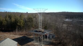
Fig. 1: Tools of the trade — typical equipment setup for mobile FM field strength measurements in the cab of a truck.
Courtesy William P. Weeks
Regarding AM coverage maps: The 2 mV/m is considered by the FCC as the lowest signal level necessary to provide service in communities of 2,500 persons or more. The reality is that in urban areas, manmade noise may mask a 2 mV/m signal and a higher signal level is necessary for good reception. Also note that AM coverage maps are often created using the FCC M3 conductivity map. In many areas of the country this significantly overstates the size of the contour. Another variable that can significantly impact real-world AM coverage is summer-to-winter conductivity changes. I live and work in the New Jersey suburbs of Philadelphia. There are areas where I can hear a 5 kW AM on the low end of the dial and a 50 kW in the center of the dial perfectly in winter, but as temperatures warm up in May the signals become intermittent and in August are unlistenable in some locations.
RW:If I’m interested in the actual coverage of a potential license, what is the most important analysis to discuss with my consultant? What tools model coverage accurately?
Beverage: Station evaluation is a complex process if done properly. Consider the process to operate like a team of detectives, each with specialties.
The attorney will do the FCC due diligence and also should review lease documents and titles to owned property. The attorney(s) will look at environmental compliance as well. Often we find clients saying that they want to buy a station but the land is going to be sold; where can I move the station? Needless to say this can be particularly difficult with AM directional facilities due to the property requirements.
Generally the buyer doesn’t have a whole lot of money and the seller is getting rid of the license at a reduced price, which is what attracts the buyer. Many times the deal can’t be made because the buyer can’t afford to implement a new transmission plant, especially when it involves new property, due to the added delays, environmental costs, costs to obtain local approvals and construction costs. A suitable tower site lease, if available, can often become the best and only practical solution.
Now to the engineering portion of the team. You need a good hands-on field person with a lot of station experience to go through the physical plant to find any problems and do the FCC compliance report using the FCC check list for the particular type of station. This person should drive the signal and report on the results. If the station is an FM, driving the market and recording the signal level of the FM being purchased and other FM signals that are competitors or highly rated will be valuable. This should tell you if the station is in good technical condition and can be expected to perform as predicted.
This brings us to the consulting engineer. That person should be thorough and experienced. If the station is an AM, they can do coverage maps based on measured soil conductivity to give a more accurate contour size and population. If the station is in an urban area they will caution about noise and how that impacts the signal. If the station is an FM the measured signal level will be compared to Longley-Rice predictions. If the measured and Longley-Rice don’t line up, this may indicate an antenna problem. Other stations in the market can be measured by the field engineer and given a Longley-Rice evaluation by the consulting engineer to provide independent collaboration of the differences between measured and predicted.

Fig. 2: Longley-Rice field strength prediction on Google Earth with field strength measurement data and route overlaid.
Longley-Rice signal level models that predict signal level, say 5 feet above ground for auto listening, are a wonderful tool if used with caution. Some type of land use attenuation should be added so that the computed signal is as close as possible to real-world. It does need to be recognized that the computer program providing the calculated signal level may not know where obstructions to the signal are located, such as heavy foliage or the locations of tall buildings in urban areas.
RW:The NCE reserved band is well known for having a large number of stations with power levels that don’t correspond to the class maximums. In contrast, commercial licenses tend to operate mostly at maximum class value, e.g. 6 kW at 100 meters for a Class A station. Why is there a difference in these two types of stations?
Beverage: That is an interesting question. The basic answer is this. Commercial stations are allocated based on a table of minimum distance separations between transmitter sites. NCE stations are allocated based only on the fact that the designing engineer was asked if a new NCE station could be designed to serve a particular area or community and the engineer was able to find a location, frequency and antenna pattern that fit in between the existing stations. This is one reason why often you can listen to a commercial station for a greater distance than a non-commercial. Because the allocation of commercial stations is based on full ERP and HAAT for the station class, 50 kilowatts at 150 meter HAAT for Class B and C2 as an example, and the transmitter sites are fully spaced, facilities like this generally enjoy more protection and have a greater listening radius.
How a station being considered for purchase is allocated is important for an owner to know. I say that because the FCC developed section 73.215 of the rules to allow commercial stations to operate at lesser distance separations and to employ contour clearance which can take away some of the advantage just explained above.
What I have stated above is true but there are other factors. At the beginning stages of the development of the commercial FM band, station separation was based on interference, which is why you see situations like WCBS on 101.1 MHz in New York City and WBEB in Philadelphia on 101.1 MHz 130 kilometers apart; but 73.207 says that the required minimum distance separation is 241 kilometers site to site for two Class B stations. Clearly grandfathered stations like these cannot enjoy the full wide-area coverage that stations that are fully spaced enjoy.
RW:The FCC uses something called the F(50,50) contour which is used to calculate the coverage area, but when discussing interference to another station instead they use a slightly different one known as the F(50,10). What is the difference and what do those numbers mean?
Beverage: Many broadcasters tend to think of FM and TV signals as being constant which is not accurate. FM and TV signals operate in what we call the VHF and UHF frequency bands. Signal strengths in this frequency range are impacted by weather, atmospheric effects and sunspots.
The propagation curves that are used to predict signal levels rely on three statistical categories.
The first, TimeVariability, accounts for variations of hourly median values of signal attenuation due to, for example, changes in atmospheric refraction or turbulence. The computed hourly field strength is an hourly value. The actual field strength at the receiver location would be expected to be above that value during half of the time and below half of the time. Time variability is expressed as a percentage from 0.1 percent to 99.9 percent, and gives the fraction of time during which actual received field strength is expected to be equal to or greater than that computed by the program.
Location Variability accounts for variations in long-term statistics that occur over the path from transmitter to receiver. The variability is related to differences in terrain profiles from the site to each receive location or environmental differences between the paths such as over water, a forest, a field, suburban housing or urban setting. The location variability for the calculation is also expressed as a percentage from 0.1 percent to 99.9 percent. This value gives the percentage of locations where actual received field strength is expected to be equal to or higher than the median field selected in the program by the user.
Situation Variability accounts for variations between systems with the same system parameters and environmental conditions, including differences in the ability of individuals to accurately take field strength readings. This is the place where unconsidered variables enter, variables whose effects we do not understand or which we simply have not chosen to control or consider. The values could include a measured transmitting antenna radiation pattern — many times, Longley-Rice signal level predictions consider omnidirectional FM stations to have a true omni pattern, which is rarely true. If you have ever done mobile FM field strength measurements you have probably wondered, “How did that big metal tractor trailer impact the signal level as I passed by?” The effects of differences like these clearly change the statistics. Situation variability describes the effects of the changing conditions. The situation variability for the calculation is, as you might have guessed by now, between 0.1 percent to 99.9 percent. This value gives the percentage of paths on which actual received field strength is expected to be equal to or higher than the field computed by the program.
Entering higher percentages of time, location and reliability values effectively reduces the variability resulting from these factors. The resulting field strength predicted by the program will be lower, but with increased reliability that the actual field that could be measured would equal or exceed the computed value at any given time. Typically for coverage all variabilities are set to 50 percent and for interference time is set to 10 percent because we want to limit the amount of time that interference will occur.
The FCC uses location and time variability only. The F(50,50) curves are used to determine coverage based on 50 percent of the locations and 50 percent of the time. The F(50,10) are used to predict interfering contours for 50 percent of the locations and 10 percent of the time.
The FCC uses the 50 percent of the time values to predict coverage because it puts the signal level right in the middle of the variable. The 10 percent of the time variable is used to account for the fact that for a given radiated power and contour value the interfering contour will go a greater distance and using F(50,10) for interfering signals provides the needed separation to prevent interference under typical conditions.
Let’s think for a minute about real-world signal levels and apply the math. I can’t tell you how many times we have gotten calls, especially toward summertime, from a new broadcaster saying “Something has happened to our signal, our station is gone and now all I hear is W— three hundred miles away!” When we explain this is atmospheric ducting that occurs during certain times of the year, it can’t prevented and it is a statistical likelihood, maybe 1 percent each year, the statistics start to make sense. Broadcasters in Los Angeles, San Diego, the Gulf of Mexico and along the NE coastline typically are more likely to experience these problems.
This story is excerpted from the Radio World eBook “Propagation Analysis for Profit,” one of the growing Radio World library of free eBooks.

RW:Why is it necessary to reduce the effective radiated power of an FM station as it increases the height or HAAT of its antenna?
Beverage: FM is predominantly a line-of-sight transmission medium for greatest signal strength followed by zones of reduced signal. The most important consideration is that for a given radiated power, the signal goes a greater distance as the antenna is raised above the ground.
This can be related to light. If you are in a flat field and you hold up a light at night above your head, you see the light only so far away. As you go further away land obstructs the brightness but perhaps you can still see that there is a brighter spot on the horizon around the light, which would be considered to be a weak signal. If you raise the light higher and higher, you can see it further and further away — line of sight at work.
To complete the answer: If the power is fixed and you have clean line of sight to the receiver from the transmitting antenna, the direct signal does not change significantly. Given what I have said, you can see that the reason that the radiated power has to be reduced above a given height is to maintain a specified signal level at a given radius.
In terms of understanding, the path from the transmitting antenna to the receiver consists of zones. The first zone is the area where the path from the antenna is clear line of sight. The second zone is what we call the Fresnel zone, where some of the energy around the radio beam starts to be attenuated by obstructions. The third zone is an area beyond line of sight where the signal has bent over the earth and is weak but potentially still listenable or able to cause interference.