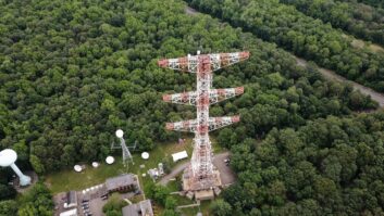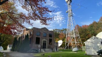
The long shadows are often a dead giveaway when you are “tower hunting” with Google Maps. Here, part of Philadelphia’s Roxborough antenna farm.
Consultant and friend to Radio World Bob Gonsett passes along a tip that shows the fun you can have with online satelite imagery.
“Google Maps has been updating their aerial photos, and KFI’s new tower with its capacitive top hat is now visible,” Bob writes in his latest CGC Communicator newsletter, providing these further directions for an unusual view of the transmission structures of the Clear Channel AM station in Los Angeles:
1. Go to: http://maps.google.com/
2. In the Google maps search box put: 33 52 47N, 118 00 50W
3. Hit the Search Maps button and the main KFI tower will appear in about the center of the page (look for the circular fenced antenna yard).
4. Push the slider bar in the upper left corner of the page toward the “+” sign for an enlarged view.
5. To the left of the main KFI tower but before Trojan Way is a smaller circular yard, and centered in that yard is KFI’s aux tower and white colored tuning house (look closely).
Thanks Bob. Every time someone mentions an image like this, I end up losing 15 or 20 minutes more in distracted tower ogling from on high, via Google Maps or Wikimapia, perhaps eyeballing the parking lot where I used to park when I worked at WDEL/WSTW, or checking out structures like Sutro Tower or the mast atop 4 Times Square, or touring the Roxborough antenna farm in Philly.
OK, boss, I’m going back to work now … just one more tower … 😉


