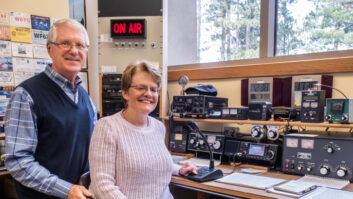
AM radio is still very much alive and profitable in Minnesota, especially in small towns.
I love these places because they offer news, information and flavor for the local communities being served. It is in those towns that the owner/manager of the station will often corner me to say, “The AM is not reaching out as far as it used to … and would you please check it out.”
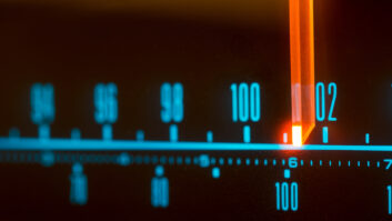
In most cases, the station is nondirectional, and no full or even partial RF proof-of-performance measurements were ever taken. None is required under FCC rules for nondirectional operation. If there were previous measurements, I could go out and check field intensity at a few previously measured points to confirm or deny the manager’s claim.
Put GPS to work
Assuming no previous field intensity measurements were ever taken, there are several approaches.
I could order 15-minute topographical maps and spend most of a week plotting radials, driving to points on those radials, measuring the points and analyzing the signal levels. This may be a bit much for a low-budget local station.
I could use a road map and plot some radials within two miles of the tower and measure wherever possible. However, this can lead to errors when the map is not easily scaled. The measurements could be far enough off to give misleading results.
A third approach seems to take care of most of the above problems.
Use a Global Positioning System unit to get the coordinates of the tower. This is important because the licensed location may not be the actual location. Then drive around making measurements wherever it is convenient and include a set of GPS coordinates with every reading. In this case, I mean 20 or more measurements within two miles of the tower. This can be done in less than two hours.
I did this recently at a station and was amazed at how quickly measurements could be made and logged. I was able to pick locations with a minimum of potential power line interference and I did not need to find specific locations to measure.
As long as I took at least four measurements in each of four directions, I could be reasonably assured that the antenna efficiency could be estimated. Again, I was not driving in straight lines. I took measurements wherever it felt good to do so.
Quick check
Back in the office I ran calculations on distance and bearing from the tower. Distance is the most critical as measurements change quickly when they are made near the tower. That is why the GPS is so important.
I compared those readings against expected readings at each distance based on estimated ground conductivity. The readings were mathematically averaged. It didn’t take long to answer the question.
In essence, we are measuring antenna efficiency. Remember, the measurements out to two miles or so have little to do with ground conductivity and mostly reflect how well the antenna system is working. This is not data that you or I can submit to the FCC, but rather a quick check to see if things are working.
If you find the average expected signal strength is low, it is time to spend the money by getting maps and doing a full analysis of the signal. I should point out that all measurements are dependent on the station running the correct amount of power in the first place. This means tuning the transmitter, as per the manufacturer’s instructions, for the rated efficiency. The antenna current should then match what the license says.
If it does not, more work is required to verify the exact power before any field measurements are done.
Thanks to Mark Mueller of Mueller Broadcast Design for some advice on this one. His Web site is www.muellerbroadcastdesign.com.