This is the second in a three-part series about radio traffic reporters. (Read Part 1.)
Radio traffic reports are not exactly buried on the programming clock. In fact, it’s usually quite the contrary.
Nearly all of the round-the-clock all-news formatted stations run traffic every 10 minutes, including the five we talked to for this feature: Audacy’s WINS(AM/FM) in New York, KYW(AM/FM) in Philadelphia, KNX(AM) in Los Angeles and WBBM(AM/FM) in Chicago, as well as Hubbard Media’s WTOP(FM) in Washington, D.C. Same for iHeartMedia’s news/talk WBZ(AM).
iHeart’s news/talk-formatted WTAM(AM) runs traffic and weather together every 10 minutes in morning drive, every 15 minutes afternoons — the late Mike Trivisonno, a legend in Cleveland, felt 10 minutes was far too frequent — and at the top of the hour for middays and evenings.
For Townsquare Media’s talk-formatted WKXW(FM) in Trenton, N.J., there’s a Jersey traffic report every 15 minutes, even on the weekends, “when the music comes out to play.”
They are often delivered precisely down to the same second.
For WBBM and WTOP, it’s traffic and weather together on the 8’s after each hour. KNX runs traffic and weather on the 5’s. WBZ has traffic and weather on the 3’s.
WINS runs traffic and transit on the 1’s, while KYW does it on the 2’s.
All these reports can take up quite a bit of airtime — even as concise and prompt as the reporters we spoke with strive to be.
The timing follows routines — but what about each of the area’s trouble spots?
In this part of our “Beat the Traffic” series, we asked each of our eight radio traffic reporters: Which roadways in their reporting areas are worst? And is there one event, in each of their years covering traffic, that stands out most?
Then, in a final sidebar, we get to the bottom of a burning question New Jersey residents have sought to resolve, once and for all.
Conflations and concrete canyons
It’s sometimes just troublesome to articulate to listeners which roadway is which. But that’s part of the art of reporting traffic.
“That is what separates an app from a real person,” Total Traffic’s Jill Myra told us.
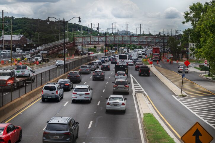
WTOP’s Dave Dildine has this problem with Interstate 295 and DC Route 295. The two are often conflated, even though the entire corridor is named the Anacostia Freeway.
“Except DC-295 isn’t a freeway. It’s actually an urban expressway,” he said. It’s also Kenilworth Ave., well, at least the service road in the northeast portion of the District. That’s until the Maryland state line, where the entire six-lane roadway suddenly becomes Kenilworth Ave.
“But only for a quarter of a mile up to U.S. Route 50, where the same stretch of road that just turned from DC-295 to Kenilworth Avenue changes to MD-295. Except MD-295 isn’t signed because that would be too easy. Instead, the road is known as the Baltimore-Washington Parkway until you get past Fort Meade, where the parkway is known as MD-295.
“Still with me?” Dildine deadpanned.
It must be something about 295 — which is actually eight interstate highways — because Myra noted that Interstate 295 runs north/south in New Jersey but becomes an east/west interstate on the Bucks County, Pa., side of the Delaware River, and this can be a chore to untangle on the air.
“I always laugh that I-95 is a seamless route from Florida to New Jersey, and then we muck it all up,” Myra explained.
Dave Dildine has long lamented the congestion and confusion that stem from D.C.’s busiest roads: Interstate 395 and Interstate 695.
“For decades, colloquially and collectively, they were known as the Southeast/Southwest Freeway, but more drivers have started referring to them by their numbers in recent years, forcing traffic reporters to adapt,” he said.
“One is signed as north-south and the other as east-west, both with cardinal directions built into their names, which adds to the confusion. Even worse, they have two different exit number schemes, one sequential and the other mile-based, which is ridiculous. The District has tried and failed to renumber these freeways in a more logical way.”
It might be easier, meanwhile, in the New York City tri-state area, to name roadways around rush hour that actually flow normally.
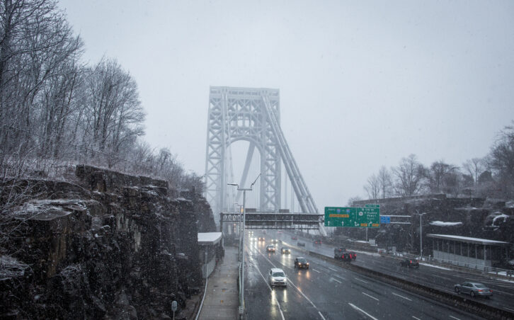
But WINS’ Greg Rice said the George Washington Bridge is often the bottleneck leader, for several reasons. There are five major approaches, Rice said, between the West Side Highway, Harlem River Drive, Cross Bronx and the northbound and southbound Major Deegan Expressway, that all lead to the bridge, not to mention from the Fort Lee, N.J., side.
“One small problem, or a construction in the wrong place, and you’ll be feeling the pain for hours,” Rice said.
In Brooklyn, the Belt Parkway is the bane of the borough’s existence, for the simple reason, Rice said, that there’s no clear-cut alternative when it gets bad.
“Between the fact that there’s no service road, or even anything that runs roughly the same path nearby, once you’re on it, you’re pretty much stuck with it.”
Living in Southern California, the freeway that doesn’t disappoint for backups, according to KNX’s Sabina Mora, is “The 405,” or the San Diego Freeway, as it runs through the Sepulveda Pass. “It’s a heavily congested freeway on a regular day,” she said.
But a long-term paving project overnights plus monthly weekend-long lane restrictions have added to the slowdowns.
In Chicago, WBBM’s Beau Duran feels for commuters who have to make the trek each day back to the city’s western suburbs. The Eisenhower and Stevenson Expressways each have points on the city’s western boundary where they go from four lanes down to three. “It makes for miserable drives anytime from 3:30 p.m. to about dinner time,” he said.
Similarly, of the traditional bottlenecks in and around Philadelphia, KYW’s Stevie Reese cited the Schuylkill Expressway, Interstate 76, westbound at the interchange for Roosevelt Blvd./City Line Ave., U.S. Route 1. “Five lanes merge into two,” Reese explained.
The Pennsylvania Turnpike also jams up for several miles, daily, at the Interstate 476 interchange in Plymouth Meeting. But it’s a recurring theme. “Most people just seem used to the delay and factor it into the time they need to get from place to place,” Reese said.
That includes the E-ZPass fees. “There’s just not many convenient ways to get around the Turnpike tolls,” she said.
A lack of traffic cameras, WBZ’s Gina Tempesta said, makes the O’Neill Tunnel, built as part of the “Big Dig” in Boston, tops on her list in and around Boston.
“That can quickly domino into backups that affect the entire downtown ride,” she said.
In Cleveland, “Deadman’s Curve,” the nickname for the nearly 90-degree bend on Interstate 90 near Burke Lakefront Airport, often fills Pat Butler’s WTAM traffic reports.
Traffic and weather are often presented together — and Butler said that often the worst spots are totally weather-dependent.
“When a lake-effect snow on the east side of Cleveland starts dumping at 5 a.m. and the road crews didn’t get a chance to pre-treat the way they would overnight, places you would not expect get backed up,” he said.
Blind spots and jurisdiction triangles
There is a notorious jurisdictional “Bermuda Triangle” at the Kenilworth Avenue-Route 50 interchange, Dildine told us, where U.S. Park Police, Prince George’s County Police, Maryland State Police and D.C. Police all share responsibility for different slivers of the intersecting roads and ramps.
“Response times are longer there, which means information is slower to surface,” he said.
The Canal Road-Arizona Avenue intersection near the Chain Bridge, Dildine noted, is another frustrating blind spot.
“These are relatively low-capacity roads that dictate traffic flow in a disproportionately large way and, since they’re confined, reversible roads with limited sight distance,” he explained. As a result, reports are few and far between.
It’s all part of the experience navigating the roads in that portion of the District.
“Driving in Northwest D.C. during rush hour will offer you the unique experience of being on some roads that suddenly change direction at certain times of day, turning everything you’ve learned about driving to the right of the double yellow line upside down,” Dildine said.
Unforgettable wrecks and weather events
When it comes to truly historic backups on the roads, certain events become permanently etched into a reporter’s memory.
Sometimes it’s a noteworthy speaker at a venue that typically wouldn’t host such an affair. Tempesta recalled when President George W. Bush spoke at Boston University’s commencement in 1989, causing delays on Boston’s Storrow Drive and the Mass Pike, Interstate 90.
Any presidential or funeral procession, she cautioned, can adversely affect a highway’s flow of traffic.
Perhaps more recently, it’s every time Taylor Swift has appeared for a concert at Foxborough’s Gillette Stadium.
“It causes backups for hours like I’ve not really seen before,” she said.
In D.C., Dildine said there are three events that come to mind.
In September 2011, flash flooding from the remnants of Tropical Storm Lee led to an extraordinary number of water rescues in Maryland and Virginia. “It is the only time I’ve ever seen dangerous, swift-water rapids overtake the Capital Beltway,” he recalled.
Between WTOP’s traffic on the 8s and special break-ins, Dildine said he fielded call after call from frightened drivers. “I vividly remember talking to one panicked person who called from the roof of their car, surrounded by the Accotink Creek,” he said.
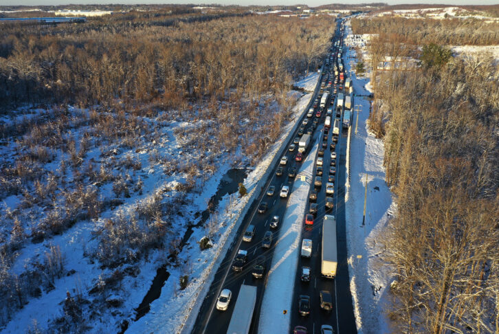
He had a similar experience on Jan. 3, 2022, when thousands were trapped in their vehicles during a winter storm on Interstate 95 in Stafford County, Va., leaving more than 830 cars stranded overnight.
“It is one of the only times I’ve ever employed adjectives like ‘nightmare’ and ‘disaster’ to describe traffic,” he said. He spent the night speaking with people he said were inconsolable. “Think about that next time you sit in a bad traffic jam. It can always get so much worse,” Dildine said.
Dildine has done more, in fact, than just talk drivers out of such jams. In January 2019, during a heavy snowfall, he was tracking conditions on foot in Rock Creek Park when he heard a woman drowning in the creek. Before he could call 911, he dropped his phone in the snow and went in, heroically, to pull her out of the freezing water himself.
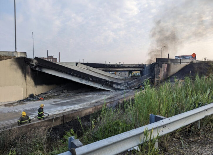
Up in Philadelphia, a tanker truck in June 2023 carrying approximately 8,500 gallons of gasoline crashed and caught fire under I-95, making international headlines. The fire caused the northbound lanes to collapse and made southbound lanes unstable.
“Having such a large part of a heavily traveled interstate closed for 24 hours a day for rebuilding caused major headaches,” KYW’s Stevie Reese recalled.
Temporary lanes were built within two weeks, but returning to normal, particularly for truck traffic, Reese recalled, took quite a while.
In Chicago, the worst mess Duran could recall happened in April 2020, right during the onset of the pandemic. There was a late-season snow and ice event, and with so few cars on the road, he recalled, vehicles were driving through at highway speeds — or greater. In the blink of an eye, a massive 54-car pileup on the Kennedy Expressway occurred on the north side of downtown Chicago. The road was shut down for several hours.
“Because of COVID, it became one of the crazier days of my career,” he said.
Out west, Mora remembered a brutal weekend delay in July 2024, when a semi-truck hauling lithium-ion batteries rolled over and caught fire on Interstate 15 near Baker.
“That portion of the northbound 15 freeway is the way many travelers get to Las Vegas from California,” she explained. Because the hazardous materials burned for days, lanes were blocked for over 36 hours, stranding weekend desert travelers in extreme summer heat.
New Jersey’s Myra named several tropical systems that tested her limits — Hurricane Floyd in 1999, Irene in 2011 and most notably Sandy in 2012.
There was the unexpected November 2018 gridlock-inducing snowstorm that still triggers painful memories for New Jersey residents on both sides of the state.
But it was during the legendary Jan. 7–8, 1996 blizzard that Myra camped out at the station for several days straight.
“I have complete awe, respect and gratitude for the first responders, hazmat teams, DOT crews and the many others involved in getting roads reopened after a disaster,” she said.
A glimmer of hope
If you’ve just completed an arduous journey to your summer vacation destination of choice, you might not agree with the following assessment. But the astute Dildine, who received the American Traffic Safety Association’s national media award in 2020 for his reporting on highway safety, provided an anecdote we loved — could the epic, endless backup be a thing of the past?
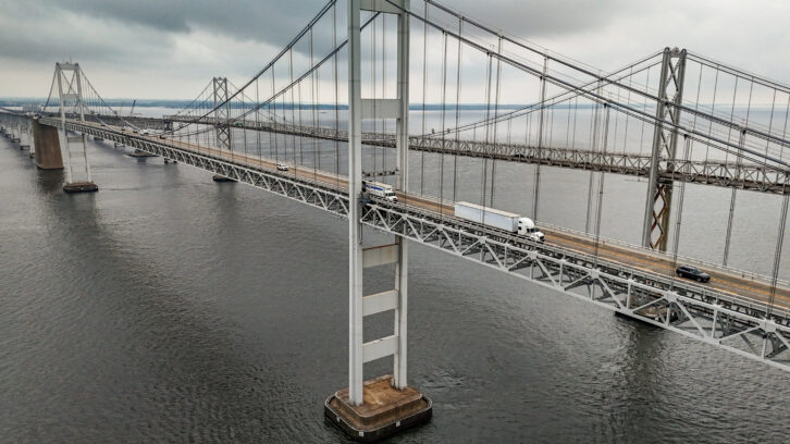
Dildine recalled a getaway afternoon during the summer around 15 years ago. An eastbound backup on U.S. 50 in Maryland extended from Bowie to the Chesapeake Bay Bridge. It was more than 20 miles long.
“Nothing even remotely close to that has happened since,” he said.
His hypothesis is that we may never experience the extreme backups that formed before widespread smartphone use.
“No one would knowingly put themselves through something so tortuous,” he said.
The combination of flexibility, time-shifting and continuous rerouting has resulted in travel demand that gets spread out temporally and spatially, Dildine explained.
“I believe it has mitigated more extreme outcomes,” he told us.
The Taylor Ham Line
For just about as long as WKXW has run up the “New Jersey 101.5” FM talk format, which it picked up in 1990, it has divided traffic coverage for the northern and southern parts of the state.
That’s understandable, with New York City’s influence to the north, and Philadelphia’s to the south.

Myra delivers traffic from WKXW’s Ewing, N.J., studio as the voice of “Jersey Traffic South.”
But defining exactly where that territory shifts to the northern half of the state is a legendary geographic and cultural quandary.
“It’s like the age-old state argument: Pork roll or Taylor Ham,” she said.
According to Myra, the state’s two main north-south toll roads act as the official operational barrier.
The New Jersey Turnpike, from Mercer County southward, acts as the domain for Jersey Traffic South. Meanwhile, Interstate 195 east of the Mercer/Monmouth County line, which transports shore-goers across the waistline of the state, falls under the territory of her counterpart and fellow Montclair State alum, Bob Williams, on New Jersey Traffic North.
Down the shore, everything north of Exit 63 on the Garden State Parkway in Manahawkin belongs to the north.
“But despite what the map says, yes, there is a Central Jersey,” Myra cautioned.
And here’s a link to Part 3, in which our traffic reporters talk about how they distinguish themselves from mobile apps, the value of listener tips and their on-air delivery strategies.