Nick’s Signal Spot is a new feature in which Nick Langan explores RF signals, propagation, new equipment and related endeavors.
Maybe you’ve been on the other end of a listener phone call during the summer or fall months.
“What happened to your station? Did it go off the air?”
All is well at your transmitter site. But even within a station’s primary coverage area, a tropospheric band opening can be intense enough to produce interference on the same frequency.
The lowest layer of the Earth’s atmosphere, the troposphere, can wreak havoc on the VHF and UHF bands, including the FM broadcast band, for hours at a time or even longer.
This is fairly typical along the Atlantic coastal plain in the warm season and into the transition to autumn, as well as in the Great Lakes region, as meteorologist Allan Nosoff detailed in August.
If you turned on your car radio this morning and heard Detroit instead of Cleveland, you’re not alone!
This is one of the ways you can hear or see radar noise when there is no rain at all. Check this out ⬇️https://t.co/jTl7bA1sgf
— Allan Nosoff (@Allan_Weather) August 14, 2025
The phenomenon is even more commonplace around the Gulf Coast. As meteorologist and tropospheric propagation expert William Hepburn noted, signals that reflect off a water surface retain much more of their strength. But as we’ll detail, the inland Great Plains region is a relative hotbed, too.
“Tropo,” as it is nicknamed, is the most common “unusual” FM radio propagation mode. When it is going really well — when ducting comes into play— it’s also my favorite.
Meteorologist Matt Sittel, assistant state climatologist at Kansas State University and a rather prolific long-distance FM radio hobbyist, said the key to tropo seems to be low-level moisture.
When warm air approaches a cool, moist surface, the buoyant warm air often spreads over the cool air, trapping it and creating an inversion.
“A cold front, conversely, clears out the warm air and ends the tropo,” Sittel said.
Corn sweat
I’ve written about E-Skip, which is mysterious and unpredictable. We do not believe it is caused by the weather. In contrast, tropo is directly related.
As Hepburn notes, E-Skip and tropo shouldn’t be confused. The word “skip” should be reserved for ionospheric propagation.
Terminology is not the only difference between the two propagation modes. E-Skip is typically fleeting. While multi-hour openings are not unheard of, they are often in shorter bursts.
Tropo, meanwhile, can span several hours — sometimes longer, although “ducting” can behave similarly to E-Skip.
There are two particular forms of tropo that most of you are probably familiar with.
The first, tropospheric enhancement, is the generalized condition when a warm, dry layer covers a cool, moist layer in the troposphere, forming an inversion. Signals bend as they cross the inversion, and once they bend, they can travel farther than in normal conditions — usually capped at about 300 miles. Sittel said this enhancement could extend in any direction.
Andrew VK3FS produced some nice graphics that illustrate what happens to signals that cross this inversion.
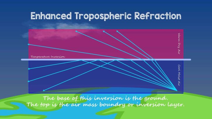
On humid summer mornings, this kind of enhancement can be a daily occurrence. Moisture is maximized near the surface before temperatures warm with daytime heating.
Sittel added that, across the Great Plains, evapotranspiration increases the moisture near the ground as plants give off water vapor.
“It is also known as corn sweat!” Sittel declared.
For long-distance reception enthusiasts, or DX’ers, like myself, the enhancement form can be a bit mundane. It’s the second form of tropo — ducting — that I find particularly captivating.
Long-haul ducts
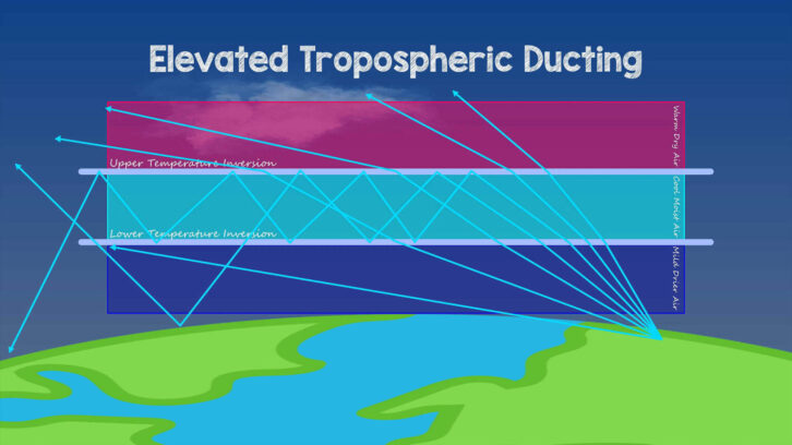
That same bending can increase enough to cause the signal to hit the ground, reflect back up into the inversion, and then be refracted down again.
Elevated ducts are the source of the longest tropospheric events. With the signals “trapped,” they can result in distant reception without any other stations in-between being received.
One of my favorite ducting moments was in September 2021, with a reception of 104.3 CJQM(FM) from Sault Ste. Marie, Ontario, at my location in New Jersey. This signal had to scale the Appalachian Mountains along its approximately 640-mile path. This was fleeting — about 10 minutes later, the signal was gone.

But I’ve been watching FM radio propagation rather fervently in North America for the last 20 years, and the most prolific such event occurred in August 2023 across the Midwest and Plains.
Sittel, from his location in Manhattan, Kan., was right in the middle of it. Listen to a conversation on the VHF DX Podcast I had with Sittel about the opening.
He heard stations as far east as Roanoke, Va., Grove City, Pennsylvania, and London, Ontario, distances of approximately 900 miles. Other enthusiasts had distances of more than 1,000 miles — a truly historic feat for tropospheric ducting over land.
What made this happen?
In August 2023, there was a large high-pressure dome centered across U.S. heartland.
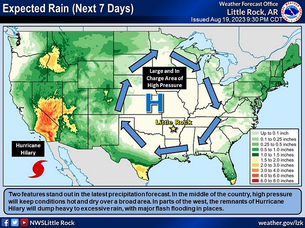
Hepburn refers to this as a high-pressure tropo, where sinking air warms and dries as it descends, trapping cooler air underneath and creating an inversion. He notes that it can last all day — which was one of the hallmarks of the August ’23 opening.
In the northern half of the U.S., the summer-to-fall transition can be particularly favorable for tropo because of greater temperature and moisture gradients, as well as the stable weather patterns September and October often favor. Along the Gulf Coast of the U.S. and Mexico, the late winter or early spring months often work best.
The best places for tropo

A May 1951 column for Radio Electronics magazine on “What’s the Mystery Behind Television DX” explained that seaside locations head the list of “desirable homesites for the VHF enthusiast.”
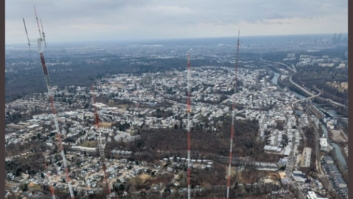
The hook-shaped peninsula of Cape Cod is not just one of America’s favorite vacation spots.
Its location, sticking out into the Atlantic, makes it an ideal location for over-water tropo, up and down the east coast.
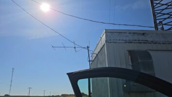
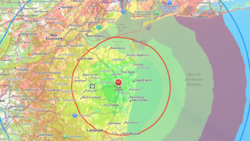
DX’er Bryce Foster lives in Mashpee, Mass., and captured this rock solid ID from 104.1 WYAV(FM) in Myrtle Beach during coastal tropo ducting on Sept. 6, at over 800 miles.
Listen to Bryce’s reception of 104.1 WYAV(FM) Myrtle Beach from Cape Cod.
He heard as far as Jacksonville, Fla., during the opening which was quite exclusive to the Cape.
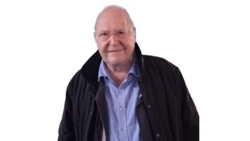
The FM stations that are located on the Cape are often reported on the “other end” of the ducts, too. Steve Solomon is the director of operations and programming for Coxswain Media’s stations, which include 93.5 WFRQ(FM), 101.1 WHYA(FM), 101.5 WKFE(FM) and 102.9 WPXC(FM).
He has been involved with radio on the Cape for more than 30 years.
A longtime FM DX’er himself, Solomon remembered an E-Skip opening so intense in July 2004 that at the former 96.3 WRZE(FM), which formerly had its Class B signal on Nantucket, the signal could not be heard 27 miles away inside “The Rose’s” studio.
“Programming had to be monitored via ‘PGM’ on the console, as ‘On-Air’ was a complete mess!” he recalled.
Today, WPXC’s Class B1 signal transmits from the “mid-cape,” considered the central part of the peninsula. Yet, Solomon said when tropo is cooking, it is not unusual for him to hear reports of co-channel 102.9 WBLM(FM) from Portland, Me., interfering near where the Bourne and Sagamore Bridges cross the Cape Cod Canal. The same holds true with a clash of Top-40 WHYA and co-channel rocker 101.1 WGIR(FM) in Manchester, N.H.
“I found myself frustrated last week when Zeppelin overtook ‘Pink Pony Club’,” Solomon joked.
For the same reasons Cape Cod works so well, tropo is certainly not just a Eastern North American phenomenon. Here is an audio clip of a BBC National DAB+ multiplex signal decoded in the Czech Republic in 2023, at a distance of more than 1600 km, which is believed to be the farthest a signal on that digital mode has been received.
DX’er Sheldon Remington, in June 1989, logged FM signals from Los Angeles and San Diego/Tijuana from Lompoc, Hawaii, distances of approximately 2,500 miles.
In almost all cases, follow the moisture, Sittel said. The Gulf of Mexico, for example, acts as a conveyor belt to transport moist air northward.
Conversely, arid areas like the Desert Southwest rarely see tropo. As a result, some of Sittel’s favorite tropo receptions from Kansas and his previous location in Nebraska involved getting into the drier environments of Colorado and Wyoming, including the I-25 corridor.
“When I see higher dew points than normal in areas like eastern Colorado, I am always on the lookout for tropo,” Sittel said.
Tall mountain ranges, like the Rockies, meanwhile, serve to obstruct signals, so you’ll never hear of tropo from Denver to Salt Lake City, for example.
Thanksgiving feast
In the cooler months, particularly in winter, the cold air naturally holds less moisture, making tropo much less likely to occur.
But that doesn’t mean it can’t happen. For those who experienced it, the tropo opening of record was the Nov. 24–30, 1986 event across the Midwest and East.
Like August 2023, the 1986 opening featured reports of unusual reception all day and all night for several days at a time. Some of the UHF analog TV logs that were reported were truly wild.
Jeff Kadet (K1MOD) was an avid TV DX’er in Macomb, Ill., who described the Thanksgiving week bonanza as the “greatest midwest tropo opening in recorded history.”
“WTBY(TV) Channel 54 from Poughkeepsie was in all day and night for two days,” Kadet wrote. “It had never been seen before and hasn’t been seen since.”
From western Illinois, Kadet watched WTWS(TV) Channel 26 from New London, Conn., at the same time as he witnessed a UHF TV translator, K36AB(TV) from Lawton, Okla., rebroadcast the wrong primary signal, WTHR(TV) Channel 13 from Indianapolis, instead of its usual KETA(TV) from Oklahoma City, due to the intensity of the tropo.
Think about how far Lawton is from Indianapolis — approximately 750 miles!
That wasn’t all. Kadet said at the same time he watched KSAT(TV) Channel 12 from San Antonio, he also received UHF TV signals above Channel 70 — yes, analog TV signals used to broadcast on channels that high — from Pennsylvania!
From the weather surface map below reflecting conditions on Nov. 27, 1986, you can see a sprawling high-pressure over Missouri, one of the ingredients for long-duration tropo.
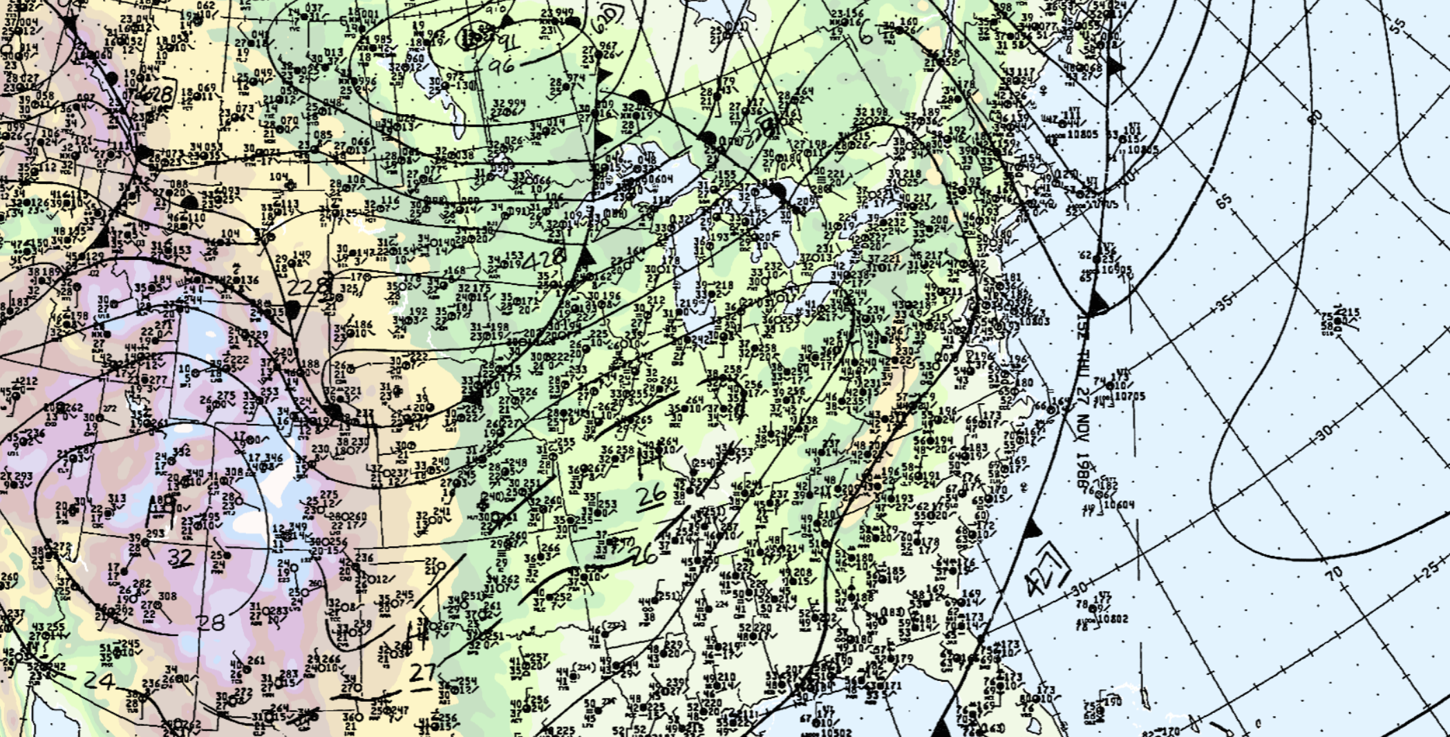
But you might also notice the air temperatures over the midwest are seasonably chilly! The mercury was in the 30s and 40s Fahrenheit.
Most of the epic logs in 1986 were reported on TV, and there can be differences within the frequency spectrum, depending on the tropo opening, as far as intensity of signals is concerned. What always impacts UHF may not to the same degree as VHF.
We’ve uncovered some of the key characteristics for tropo, but as Sittel told me, a lot is still not known.
Tropo resources
John Bisset’s Workbench covered Hepburn’s tropospheric ducting forecasts, which go out to six days for VHF, UHF and microwave radio and TV propagation. The color-coded maps should be in every engineer or manager’s toolbox — green, yellow, orange or the “extreme” pink are a good indicator of tropo intensity.
For real-time VHF observations, Jon Harder (NG0E)’s VHF Propagation Map has been around for more than 20 years and provides a fantastic way to visualize enhancement and ducts through observations on the 144 MHz APRS network.
And as Allan Nosoff noted in his X post, tropo ducts can show up on weather radar.
Armed with this knowledge, you can tell confused listeners that their radio isn’t broken — it’s just experiencing a little atmospheric havoc.
[Read the Signal Spot from Nick Langan for More DX-Related Stories]